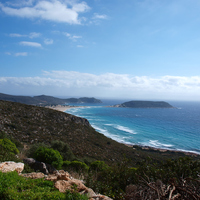
It is a 3 km route, suitable for cycling. With the new ring road linking Panagia - Kato Nisi and Sarakiniko beach, the route can be reached by car.
Starting point: Sarakiniko beach
West of Sarakiniko beach, about 100 meters from the beach and 50 meters above the coast, lies the Kournospila area, where natural caves have formed. Here we can admire a great cave, inside of which Elafonisos seems to have been born. Here shells of the Early Helladic period (3000-2000 BC) were found.
We follow the path to the west and we find ourselves in Lygia where the flowering plant Vitex (agnus-castus) grows.
Continuing to the northwest there is the place called Elies, a cultivated area where there is also a small settlement. 200 meters southeast from here, there is a low plateau of about 500 by 300 meters, where some shells and pieces of obsidian were found.
After the Elies is the Tsimbiri area.
Another area we meet in Katonisi is Lekania, a basin in the middle of the mountains. At this point some shells and pieces of obsidian were found.
From here you can reach Mount Siros.
Sources
Mentis, K., 1994, S. Peloponnesus and its “smigopelaga” islands. - Il Peloponneso meridionale e le sue isole “smigopelaga”, Elafonisos: Library of Elafonisos/Bibliotheca di Elafonisos
High School of Elafonisos, School Year 2011-2012, Stories of Elafonisos (Myths and beliefs about the place names of our island)
http://elafonisos.gov.gr


