

")

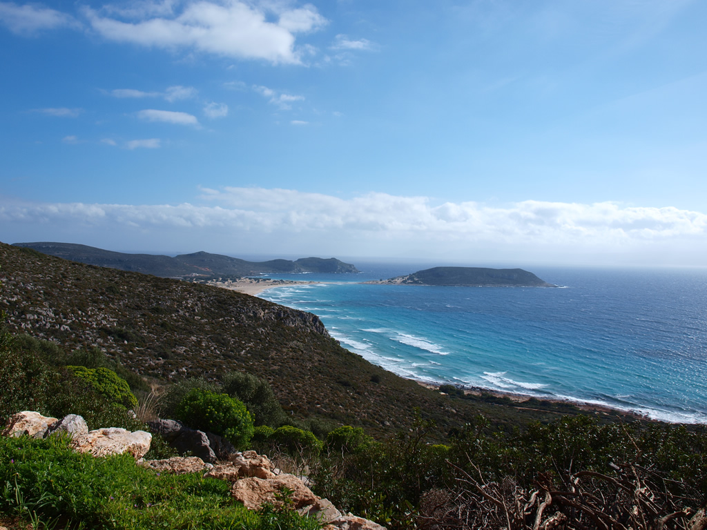
Also known as "The route of the Terraced Balconies of Elafonisos". It includes both a hiking and mountaineering experience and slowly reveals the settlement of the island with its harbor and canal, the Gulf of Vatika, the Laconian Gulf, almost the whole of Vatika settlement and at the highest terrace (Vardia) your gaze encompasses the whole of Elafonisos, the beautiful Kythera, the proud Kavo-Malia, the distant Taenaro and the blue Ionian and Aegean Seas (Dr Mentis K. 1993: 171).
Starting point: Settlement of Elafonisos
The route starts from Megalo Tigani. Continue uphill and follow the road to the left. Within 1.5 km from the west coast, there is a remarkable cave with a low vaulted roof and 400 meters NW from it there is a pile of large square stones that occupy an area of 20 by 10 meters. Here, according to the local tradition, was the sanctuary of the goddess Athena (built around the 10th century BC) as Pausanias mentions. Here, according to tradition, Paris and the beautiful Helen of Troy had stopped escaped.
Between the cave and the ruins there is another distinctive proto-Helladic location, on a small eroded plateau with obsidian and ceramic.
About 2 km from the settlement, Mount Vigla is located on a beautiful plateau overlooking the bay of Vatika, the Laconian bay and the Channel of Elafonisos.
Following the path south, we reach Vardia. It is the highest point of Elafonisos, about 276m, in the center of the island. This is an important fortified site of Elafonisos. The name derives from the Venetian word "Vardia" meaning guard. Vardia is the highest peak of Elafonisos, with a magnificent view of Kythera and the Malea peninsula. The name Vardia was given from the guards that the inhabitants did so as to inform the rest of the inhabitants about possible dangers of either pirates or enemy ships. Even in World War II, Vardia was used as a watch to warn the inhabitants in advance of any raids by speed-boats of the German Navy that were based at Gytheio. After the guards' signal the people left the village and hid in the caves in Mavroudi. It is also said that at the top of Vardia there is a deep hole leading to Kournospila (an area west of Sarakiniko). Once, as the inhabitants narrate, an old man's flute fell into this hole and it was found after a while in the sea.
It is believed that the Byzantine Castle of Elafonisos, the Deer Castle (the Ashab al baqar castle according to the Arabic manuscript no 276 of the National Library of Paris), is located in Vardia. After the conquests of Emperor Justinian (565 AD), Elafonisos, Vatika and Kythera were subordinated to the province of Illyricum. There are indications that the construction of the castle may have begun during the reign of Emperor Justinian (527-565 AD).
Alternatively, there is another way to Vardia:
West of Agios Ioannis, the settlements Kapsalianika and Spirianika are located. Here, many ceramic fragments of the Early Helladic and Late Helladic period were found.
Then there is the area of Fountianika, where plenty of clay pots of dark color of the Early Helladic era were found.
From here, we follow the road to the southwest, passing through the Kalyvia area, an old settlement of Elafonisos, mentioned in the French maps.
Other places:
Akriovatos or Akrokovati: It is an arable area near Vardia with many fields and a wonderful view. It was named after the brambles (thorny shrubs) found in the area.
Fidoloutsa is an area near Vigla where snakes go to drink water. According to a local legend, a haunted snake lived in this area. The rattling of his tail prevents any grass from growing there.
Sources
Mentis, K., 1994, S. Peloponnesus and its “smigopelaga” islands. - Il Peloponneso meridionale e le sue isole “smigopelaga”, Elafonisos: Library of Elafonisos/Bibliotheca di Elafonisos
High School of Elafonisos, School Year 2011-2012, Stories of Elafonisos (Myths and beliefs about the place names of our island)
http://elafonisos.gov.gr